The engagement of this project has ended
 Corby Walking & Cycling Plan
Get project news
Do you want to receive an email when news items are posted?
News on Corby Walking & Cycling Plan
Back to newsLaunch of Corby Commonplace Map
Launch of Corby Commonplace Map -
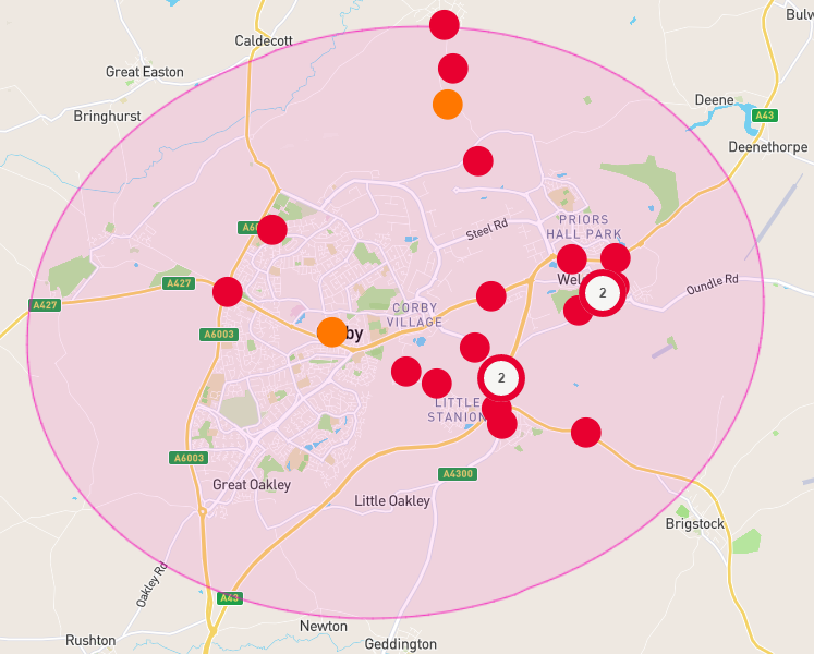
The Corby Commonplace heat map which allows anyone to pin and upvote comments about the walk and cycle infrastructure needed in Corby and the local area, is now live and will remain open at least until late October.
This facility provides a really easy way for local people to have their say on the travel issues they currently face and possible solutions. It has already seen quite a few contributions as indicated on the image above. Suggestions can include better crossings, speed calming and segregated cycle routes. Its positive approach means people can upvote (but not downvote) other comments. Those who do not agree with a comment can instead place their own comment and idea which others can upvote if they agree.
We are trying to reach a wide, representative range of local people and will be promoting this facility widely and directly with local organisations and businesses to ensure this. Anyone age 13+ can take part so we will also be promoting through local secondary schools too.
All the information will be used to help create a new 10 year walking and cycling network plan for the area. The measures within it will need to comply with the government's new LTN1/20 guidance - for example painted cycle lanes are not considered adequate protection for cyclists. A good quality final plan will enable North Northants Council to apply for government funding to put the measures into place.
Add your comments to the Corby Commonplace Heatmap here.